Flanders region
Consulting sewer network information, trace the sewer network and alert sewer network issues by using a mobile client
The Pilot in Flanders is the first step within the Flanders Environment Agency to make information about the sewer network available on the field without having to print paper plans.
This means that the field workers can be more flexible on the field. For example, they can anticipate on sudden urgent changes in the planning without having to come back to the office to get the necessary information.
The pilot is organized around two use cases:
The first use case focusses on the accessibility of sewer network data in a mobile application. The viewer that is developed, both web-based and mobile, will become available for citizens, fellow workers within VMM and sewer managers (municipalities and commercial companies). At first the management of the data on the field was the main focus of this use case. Regular feedback moments with stakeholders however, resulted in a shift of the focus to tracing of the sewer network.
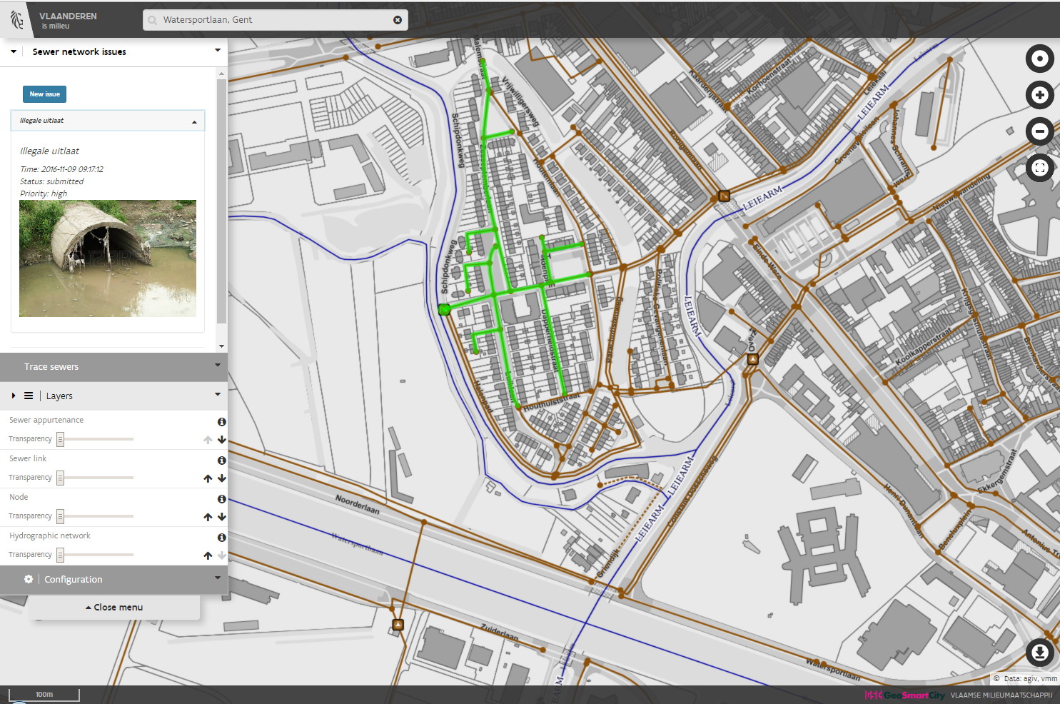
The tracing functionality makes it possible to trace the route of substances (sewer water, pollution, access flood water, …) through the sewer network to find the source (upstream) or outfall (downstream). The tracing can be started from any node in the network and will help field workers to limit the search area for incidents and hopefully be faster at site to find the cause or perpetrator and prevent health and environmental damage.
Another use case was created to make it possible to alert issues in the sewer network (crowd sensing platform).
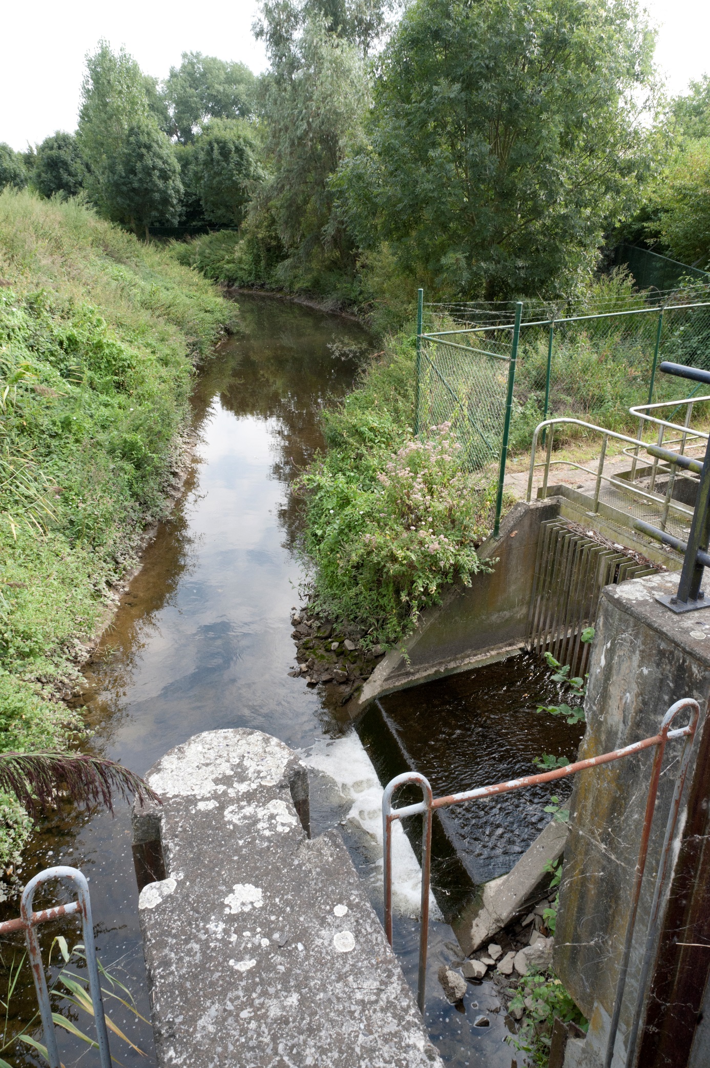
Citizens or other non-professional users (like civil servants with no connection to sewer system management) can report an issue on the sewer network. The VMM will distribute the problems to the responsible organization managing the sewer infrastructure. By using the application, it is possible to add a location and a picture of the problem. Professional users can of course use the application in a similar way, but can interpret the available data in a more complex manner, making use of their own knowledge. For example, supported by their knowledge they can give a more detailed description of the observed problem or make a picture of a problem while doing excavation work.
Functionality
The pilot web based client application offers the following functionalities:- Map + basic map controls
- The client was based on the GeoAdmin product, more information and the source code can be found at this Github page.
- Change order and transparency of layers
- Change background layer
- Search for Address
- Go to current location (using GNSS position of mobile devise itself)
- Get object/feature info
- Visualization tool (zoom, pan, full extension)
Access the application
Interested?
GeoSmartCity Hub components used
Sewer network viewer video
Training Material
 Learn more by following this presentation in our eLearning platform.