South Moravian Region
Mobile apps for public administration and utility companies.
The pilot splits into two separate branches, one for crowdsourcing support for public administration and one for utility companies. Both branches will deploy mobile clients, targeted to Android platform, with a different functionality.
Although the pilot is primarily focused on mobile applications, both of them need a background support, in form of a server-side services, to work properly.
Crowdsourcing app
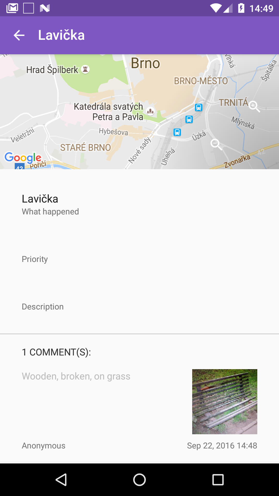
After discussing the crowdsourcing application with the Brno City administration, it was decided to use the application at the first phase also for the update and adjustment of city mobile assets like park benches, waste disposal baskets, sewage manholes, and other minor assets.
Some of aforementioned items have already been identified in the field using the orthophoto map, but detail descriptions of attributes as well as photography have been missing. Therefore, an extensive fieldwork was organised during August and September in order to test the application and develop the mobile assets database for the central Brno City district.
For this purpose existing data (shapefiles) were converted and imported into crowdsourcing database as existing events. The events have most of their attributes blank, but asset type and its location. A user opening the mobile application can see a lot of events.When selecting an event, it can be commented, including a photo. And that is the core functionality used in this case. For example, a park bench can be commented specifying that its wooden bench without backrest located at paved area, and its photo can be attached. So the application is not used primarily to create new events, but comment existing ones.
After collection of the comments the data will be exported and transformed into a form acceptable by the Brno City administration.
Utility Viewer app
The main idea of the second branch of the pilot is to enable utility companies to view underground infrastructure, such as sewage, water and pipes, electrical cables, directly on the street using a mobile device with Augmented Reality (AR) support. The application offers the following functionality- View infrastructure in 2D map.
- View infrastructure using AR.
- Get information of infrastructure element.
- Use external GNSS device.
- Sent-out a new location of infrastructure element.
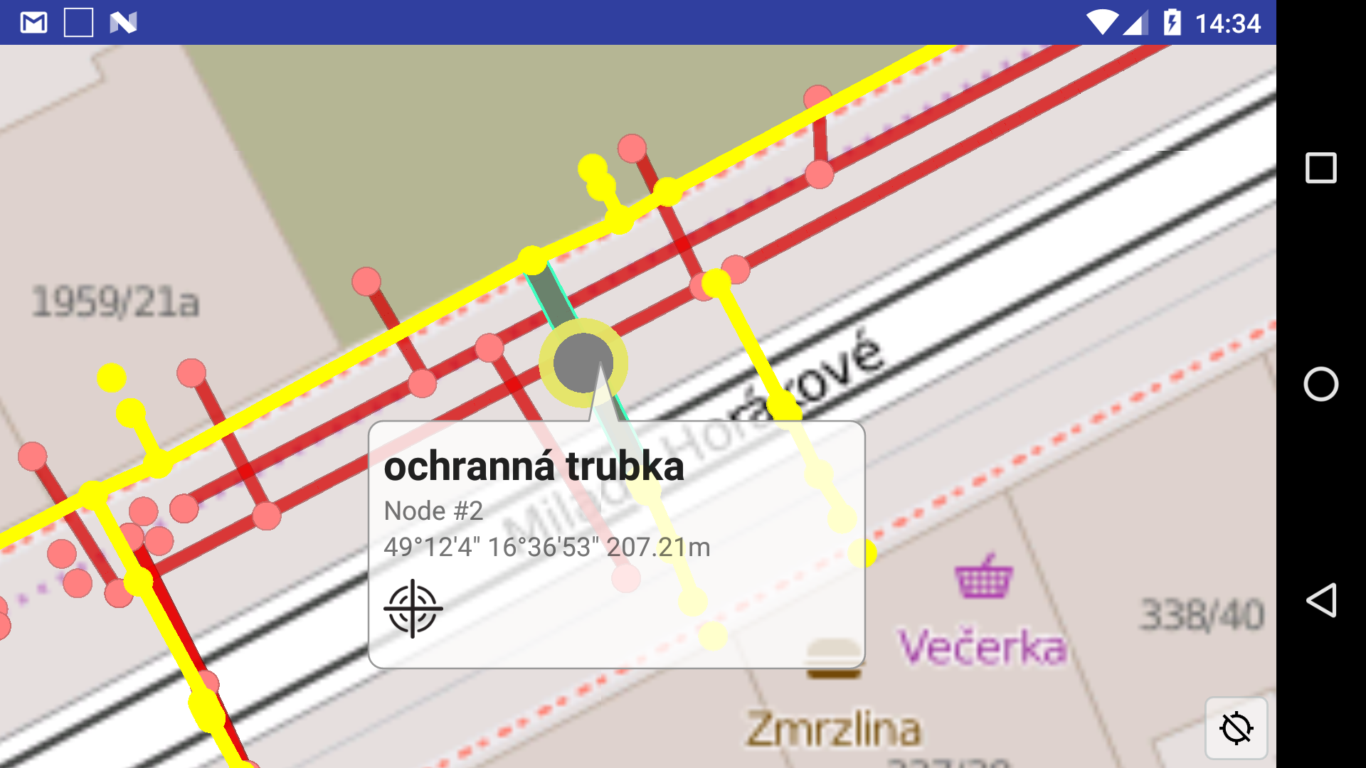
2D Mode
Utility view provides mainly the following functionality
- View underground infrastructure on top of 2D base map.
- Change layers visibility.
- Get information of infrastructure element when touching it.
- Attach to external high-precision GNSS device. Devices communicate using Bluetooth technology and user has to pair the devices prior to the communication is established.
- Correct location of nodes of the infrastructure.
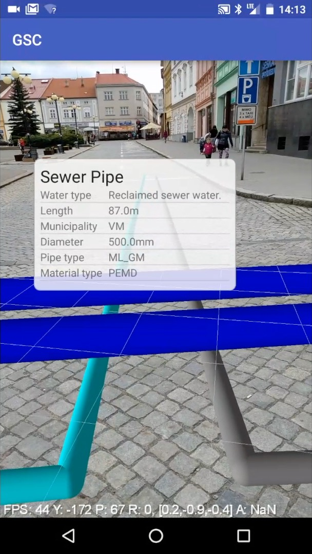
AR Mode
In the AR mode application offers user a view of underground infrastructure as an overlay of real-time camera view. A basic information is displayn in form of a baloon when a pipe is touched.
Note, that the mode has very experimental nature and serves as a proof of concept rather than ready-to-use solution.
An example of the module is best visible on the videos below.
GeoSmartCity Hub components used
Interested?
Training Material
 Learn more by following this presentation in our eLearning platform.
Demo video 1
Demo video 2